Armenia Road Trip: 10 Days Driving Through the Caucasus
Contents
- Hiring a Car in Yerevan
- Driving in Armenia: What to Expect
- The Route: Day by Day
- Day 1 — Yerevan to Khor Virap (35 km south of Yerevan)
- Day 2 — Yerevan → Khor Virap → Noravank → Goris (~230 km)
- Day 3 — Goris + Tatev (30 km from Goris)
- Day 4 — Goris → Jermuk (~105 km, ~2 hours)
- Day 5 — Jermuk Rest Day
- Day 6 — Jermuk → Selim Pass → Dilijan (~130 km, ~2.5–3 hours)
- Day 7 — Dilijan: Haghartsin and Hiking
- Day 8 — Dilijan → Lake Sevan (~45 km, ~45 minutes)
- Day 9 — Lake Sevan + Noratus Cemetery
- Day 10 — Yerevan and Return
- Border and Regional Considerations
- Key Fuel and Parking Notes
- Route Summary
- Related Guides
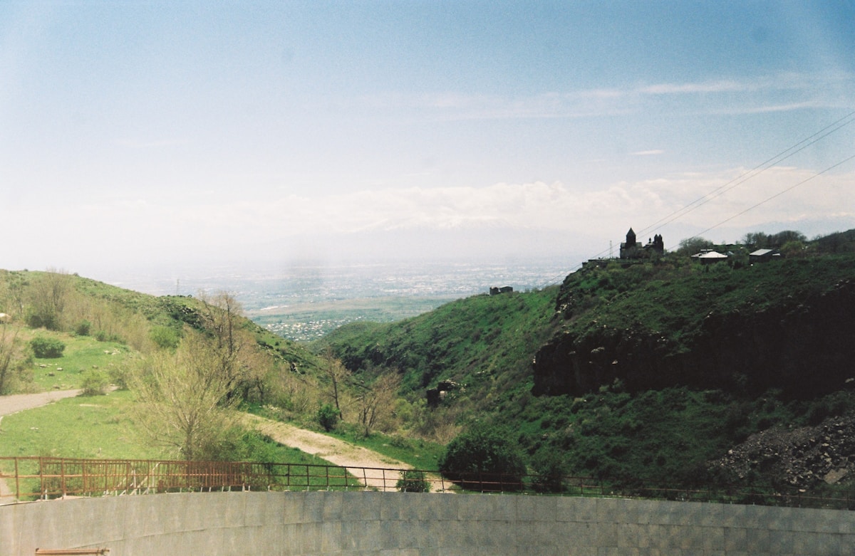
Armenia rewards self-driving more than almost any other country in the region. The monasteries, gorges, and mountain landscapes that define the country are spread across terrain where public transport either does not reach or runs infrequently. A hire car changes the entire quality of the trip — you can stop at Noravank in the afternoon when the canyon walls glow orange, take the high road over Selim Pass at your own pace, and turn off for a minor monastery that no group tour visits.
This 10-day route runs a logical loop from Yerevan: south through Khor Virap and Noravank, deep into the Syunik region via Tatev and Goris, north through the spa town of Jermuk and over Selim Pass, through Dilijan and Haghartsin Monastery, along the shore of Lake Sevan, and back to Yerevan. Total driving distance is approximately 900 km. A standard saloon car handles the entire route in dry conditions.
Hiring a Car in Yerevan
All major rental pick-ups are at Zvartnots International Airport, 12 km west of the city. The main operators present at Zvartnots include:
- Sixt and Hertz — international brands with well-maintained fleets; expect to pay 35,000–65,000 AMD per day for a compact car in peak season (2026 prices)
- Local agencies (including Advantage, Europcar Armenia, and several independent operators) — typically 20–40% cheaper than international brands; vehicles are generally fine but inspect carefully before signing
GetRentacar aggregates availability and pricing from both local and international agencies at Zvartnots and lets you compare before you commit. It also holds prices for 90 days; if rates drop after you book, you can rebook at the lower rate. Worth using to establish the market rate before going direct.
What to book:
- A standard B-segment car (Dacia Logan, Hyundai Accent, or equivalent) handles 95% of this route
- Book a car with full insurance or check that your credit card provides rental cover before declining the agency’s CDW
- Automatic transmission is available but more limited; manual is standard for most local agencies
Minimum age: most agencies require 21+; some charge a young driver surcharge for under-25s.
Required documents: your home-country driving licence plus an International Driving Permit (IDP) if your licence is not in Latin script. EU driving licences are accepted without an IDP.
Booking advice: Book at least 2–3 weeks ahead in summer (June–September). Availability at Zvartnots tightens significantly in July and August.
Driving in Armenia: What to Expect
Armenian roads vary considerably. The main M-series highways between cities are generally sealed and in reasonable condition. Side roads to monasteries and viewpoints range from good tarmac to rough dirt tracks.
City driving in Yerevan requires full attention. Lane discipline is inconsistent, traffic is dense, and parking in the centre is complicated. Use the GG app for taxis within the city rather than driving to central Yerevan if you can. If you must drive, the outer ring road bypasses the worst congestion.
Mountain roads: the route over Selim Pass (Day 6, ~2,400 m) is sealed but narrow and requires careful driving. The road to Tatev via the Vorotan Gorge is sealed and manageable. The access roads to some minor monasteries (Spitakavor, Ughtasar petroglyphs) are unpaved; skip these in a low-clearance car or after rain.
Fuel: widely available on all main routes. Petrol (95 octane), diesel, and LPG are all common. Many local cars run on LPG. Fill up before leaving any major town for remote sections — rural fuel availability is inconsistent. Prices are significantly lower than Western Europe; expect to pay roughly 450–550 AMD per litre for 95 octane (2026 estimate).
Tolls: minimal to none. You are unlikely to encounter any toll gates on this route.
Speed limits: 60 km/h in towns, 90 km/h on open roads. Traffic police are present on main highways; keep to limits, especially outside urban areas.
Navigation: Google Maps works well throughout Armenia. Download the offline map for the country before departure. Mobile signal is good on main highways and in towns; patchy in deep valleys and very remote areas. An Airalo eSIM gives reliable data across the country without roaming charges.
The Route: Day by Day
Day 1 — Yerevan to Khor Virap (35 km south of Yerevan)
Pick up the car at Zvartnots on arrival. The first stop is Khor Virap Monastery — 35 km south of the airport on the flat Ararat plain, about 40 minutes’ drive. The monastery rises from the plain with Mount Ararat immediately behind it across the Turkish border — one of the most striking views in the South Caucasus.
Arrive by late morning for the best light. The pit below the main church is accessible via an iron ladder — descend if you are comfortable with tight spaces. Allow 1.5 hours at the site.
Check into Yerevan accommodation in the afternoon. If you are arriving on an overnight flight, consider skipping Khor Virap on Day 1 and doing it en route south on Day 2.
Driving notes: straightforward motorway south from Zvartnots. No technical difficulty.
Day 2 — Yerevan → Khor Virap → Noravank → Goris (~230 km)
Estimated driving time with stops: 3.5–4 hours
Leave Yerevan early. If you did Khor Virap on Day 1, skip ahead to Noravank. If not, stop there first.
Noravank Monastery is 1.5 hours south of Khor Virap via the M2 highway and a turn-off near Areni village. The canyon approach road runs for about 7 km through red rock gorges before opening to the monastery complex. Park and walk. The 13th-century two-storey church — with its steep external staircase — is the landmark. Allow 1.5 hours.
Areni wine village is on the main road between Khor Virap and Noravank. The Areni-1 cave nearby is the oldest known winemaking site in the world (6,100-year-old winery found here in 2007). Several small producers on the main road sell local wine by the bottle; worth a quick stop.
Continue south through the Vayots Dzor highlands, over the Vorotan Pass (~2,000 m), and down into Goris. The final approach to Goris through the Vorotan Gorge is spectacular.
Stay: Goris. Book guesthouses in advance for July–September.
Day 3 — Goris + Tatev (30 km from Goris)
Drive 30 km from Goris to Halidzor village, the upper cable car station for the Wings of Tatev. The cable car descends 320 metres into the Vorotan Gorge over 5.7 km. Buy tickets at the station (return ~6,000 AMD per person, 2026 prices). The first cable car leaves around 9am; the last descent is around 6pm (check seasonally).
Tatev Monastery occupies a basalt plateau at the foot of the cable car line. The main church dates to the 9th century; the complex expanded through the 13th century. The Gavazan Column — a 9-metre octagonal column that oscillates seismically — is in the courtyard. Allow 2 hours on site.
Return to Goris by cable car. Afternoon free to explore the old stone quarter of Goris.
Driving notes: the road to Halidzor from Goris is sealed. The alternative road driving down to Tatev via the gorge road (rather than cable car) is sealed but steep and slow — only do it if you want to arrive by road rather than cable car.
Day 4 — Goris → Jermuk (~105 km, ~2 hours)
Leave Goris after breakfast. The route north passes through Sisian — worth a quick stop for the Carahunge standing stone complex nearby (also called Armenian Stonehenge — 223 standing stones on a plateau 5 km north of Sisian, some with holes bored through them. The site’s function is debated. Allow 30 minutes). Turn-off is signed from the main road.
Continue west and north toward Jermuk through the Vayots Dzor highlands.
Jermuk is a spa town at 2,100 metres, known for its naturally carbonated mineral springs. The town’s main attraction beyond the mineral water is the Jermuk Waterfall canyon — walk the path into the gorge for views of the waterfall and the basalt walls. Allow 1.5 hours for the canyon walk.
Stay: Jermuk. Several spa hotels here offer mineral-water pools and basic treatment packages. If you want to use the spa facilities, book a hotel that includes pool access in the room rate. See our Jermuk guide for specific options.
Day 5 — Jermuk Rest Day
Jermuk exists for this kind of day. Drink the mineral water at the roadside fountains (free; the main spring fountain is on the central street), use the hotel spa, and walk the upper town.
Optional side trip: Spitakavor Monastery (about 30 km from Jermuk, partly unpaved access road) — a 14th-century monastery in a remote forested setting that very few visitors reach. The road requires a higher-clearance vehicle or careful driving in a standard car. Check road conditions locally before going.
Alternatively, drive 40 km back east to Noravank for the afternoon light — if you are a photographer, the canyon at 4–5pm in good weather is worth the detour.
Day 6 — Jermuk → Selim Pass → Dilijan (~130 km, ~2.5–3 hours)
This is the most scenic driving day of the trip.
Leave Jermuk and drive north toward Vayk and then east toward the Selim Pass (2,410 m). The road climbs steadily through open highland moorland. At the summit, stop at the Selim Caravanserai — a 14th-century stone caravanserai in excellent condition, sitting alone on the pass. One of the best-preserved Silk Road structures in Armenia. Allow 30 minutes.
The descent from Selim into the Vardenis district is dramatic — the road drops steeply into a green valley. Continue north through Martuni (on the southern shore of Lake Sevan) and then east and north toward Dilijan.
Dilijan: check in and walk the old town quarter on Sharambeyan Street before dark.
Driving notes: the Selim Pass road is sealed throughout but narrow and can be slow behind trucks. Closed or difficult in winter (November–April). In clear conditions, the drive takes 2.5–3 hours with the caravanserai stop.
Day 7 — Dilijan: Haghartsin and Hiking
Morning: drive 18 km east from Dilijan to Haghartsin Monastery — three churches and a refectory hall in a forested gorge, largely restored but atmospheric. The surrounding beech and oak forest makes this feel genuinely remote. Allow 1.5 hours.
Afternoon: walk one of the Dilijan National Park trails. The Gosh-to-Haghartsin forest trail (~10 km, 3–4 hours) is the classic route. The shorter Jukhtak Valley trail (4–5 km return from the edge of town) is good for a half-day.
Stay: Dilijan. See our Dilijan guide for accommodation options.
Day 8 — Dilijan → Lake Sevan (~45 km, ~45 minutes)
Drive south-east from Dilijan along the main highway toward Sevan. The road passes through the Dilijan National Park before descending to the lake shore.
Sevanavank Monastery is the first stop — on the peninsula at the south end of the lake, 200 stone steps up from the car park. Two 9th-century churches with panoramic lake views. Allow 1 hour.
Drive the northern shore road for views. The lake is 1,240 km² and sits at 1,900 metres above sea level — the water is clear and the colour changes with the light through the day.
Lunch: ishkhan (Armenian trout) at one of the northern shore restaurants. This is where to eat it — fresh from the lake, simply grilled.
Charents Arch: a basalt arch on the road above the lake, framing a view toward Ararat on clear days. About 8 km north of Sevanavank on the lake road.
Stay: Sevan town or the northern shore.
Day 9 — Lake Sevan + Noratus Cemetery
Take the morning at a slower pace. If visiting in summer, the lake water reaches 20–22°C and is swimmable from the shore.
Drive 15 km south of Sevan town to Noratus village and the Noratus Cemetery — one of the largest medieval khachkar fields still in place in Armenia. Several hundred carved cross-stones in various states of preservation, spread across an open field above the road. Free entry. Allow 45 minutes.
Afternoon: return along the lake shore to Yerevan, ~65 km, ~1 hour.
Day 10 — Yerevan and Return
Return the car to Zvartnots. If your flight is afternoon or evening, use the morning for any Yerevan items you missed: the Matenadaran (manuscripts institute), the Vernissage Market (weekends), or the Ararat Brandy Factory tour.
Allow 1 hour from central Yerevan to the airport.
Border and Regional Considerations
Near Karabakh (Nagorno-Karabakh): Following the September 2023 military operation by Azerbaijan, the former Nagorno-Karabakh region is now under full Azerbaijani control. Armenian nationals and foreign tourists cannot access this region from Armenia or anywhere else. The area around Goris and Kapan in southern Armenia is unaffected and fully accessible. There are no road closures or security restrictions on the Goris–Kapan–Meghri route that this itinerary approaches, though you should check current travel advisories from your government before visiting the far south.
Iran border (Meghri): The Iranian border crossing at Meghri is open and used by travellers doing an Armenia–Iran overland route. This itinerary does not go to Meghri. If you want to extend south, add 2–3 days to the itinerary.
Georgia border: The main crossing is at Bagratashen/Sadakhlo in the Debed Canyon (north of Alaverdi). It is open to private vehicles. Cross-border car hire requires specific insurance — check with your rental agency before booking, as many local agencies prohibit taking vehicles into Georgia.
Key Fuel and Parking Notes
- Fill up in Yerevan before heading south — rural stations exist but are not guaranteed to be open or stocked
- Goris, Jermuk, Dilijan, and Sevan town all have fuel stations
- Tatev and Selim Pass have no fuel stations nearby
- Parking at monasteries is free and informal — pull into the designated areas at each site
- Parking in central Yerevan is charged; use the outer ring road or hotel parking
Route Summary
| Day | Route | Distance | Drive time |
|---|---|---|---|
| 1 | Zvartnots → Khor Virap → Yerevan | 70 km | 1.5 hrs |
| 2 | Yerevan → Noravank → Goris | 230 km | 3.5–4 hrs |
| 3 | Goris → Tatev → Goris | 60 km return | 2 hrs |
| 4 | Goris → Sisian → Jermuk | 105 km | 2 hrs |
| 5 | Jermuk (base) | — | — |
| 6 | Jermuk → Selim Pass → Dilijan | 130 km | 2.5–3 hrs |
| 7 | Dilijan (base) | — | — |
| 8 | Dilijan → Lake Sevan | 45 km | 45 min |
| 9 | Lake Sevan → Yerevan | 65 km | 1 hr |
| 10 | Yerevan → Zvartnots | 12 km | 20 min |
Related Guides
- Getting around Armenia — full car hire, marshrutka, and transfer guide
- 7-day south Armenia itinerary — deeper coverage of the Syunik region
- Two weeks in Armenia — extended loop including Gyumri and the north
- Tours in Armenia — organised alternatives for specific legs
Book ahead
Book the key experiences
Turn this itinerary into reality. Secure your spots — popular tours sell out 2–3 days ahead.
Frequently Asked Questions
- Is Armenia good for a road trip?
- Yes — Armenia is compact enough that you can cover most of the country in 7–10 days of driving, and varied enough that each day brings a different landscape. Yerevan, the Ararat Valley, the Vayots Dzor wine region, southern Syunik, and northern Tavush and Lori all offer distinct character.
- What type of car do I need for an Armenia road trip?
- A standard saloon or hatchback is fine for the main tourist routes. For off-road monastery approaches, a 4x4 is more comfortable. In winter months, snow chains are advisable for mountain passes.
- Can you rent a car easily in Armenia?
- Yes. Several car rental companies operate at Yerevan's Zvartnots Airport and in the city centre. International companies (Hertz, Sixt) and local operators are available. Prices are generally reasonable — confirm whether insurance covers off-road driving if you plan to access remote monasteries.